Brief: The objectives of the survey were to:
• Determine the sequence of palaeochannel infill, assess the spatial variation
of the palaeochannels in the study area, and produce a model.
• Provide a chronology for the infilling of the palaeochannels.
• Determine the archaeological potential of the sediments.
• Assess the potential for sediments to provide information about the past
environment of the area.
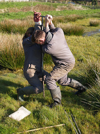
The project: ARCA drilled a series of seven geoarchaeological boreholes along the Amble floodplain in order to characterise the sedimentary sequence. Due to the challenges posed by the marshy conditions and high water table at the site, ARCA employed a combination of hand auger equipment and powered augers to drill the boreholes.
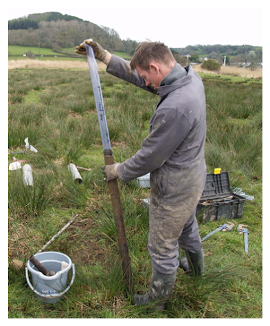
Sediments recovered in the five hand-drilled boreholes and one of the power auger boreholes were carefully described and logged in the field. A core sampler device was used for the second power auger borehole in order to recover sealed cores for laboratory analysis.
In the laboratory, the sealed cores were first scanned using a Bartington MS2C core logger to provide volume magnetic susceptibility readings – peaks in magnetic susceptibility could be indicative of periods of soil formation (i.e. periods when the build-up of sediment paused, the land surface stabilised and soils could form) or for human activity, such as burning, in the surrounding area.
The cores were then opened, the sediments were described, and a series of sub-samples were taken for further analysis. Three samples of organic remains were taken for 14C dating from various depths along the core to provide a chronology for the build-up of sediments. In addition, 20 sub-samples were taken for pollen analysis to assess the potential of the sediments to provide information about changing vegetation cover in the local area through time.
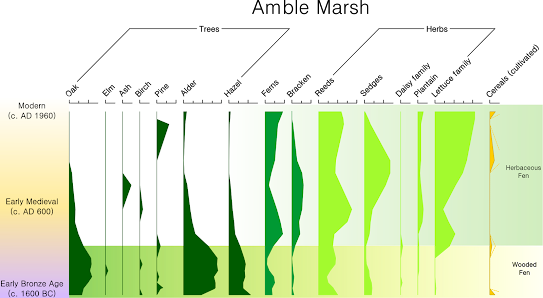
Results: The earliest sediments encountered in the boreholes were ‘Head’ deposits consisting of reworked slate deposited by freeze-thaw processes during the Late Glacial (around 12,000-20,000 years ago).
Overlying the Late Glacial sediments was a peat which developed in a freshwater marshy woodland environment, beginning in the Early Bronze Age from around 1600 BC. This was characterised by a fen-type environment dominated by Alder woodland, reeds and sedges, surrounded by woodland composed of Oak and Hazel on the surrounding drier land.
Following the formation of peat during the Bronze Age, possibly as a result of rising sea-levels, the area became an intertidal bay, with the deposition of both sands and silts and clays, indicating a dynamic estuarine environment.
In the Early Medieval period, around AD 600 the area again became a freshwater environment as shown by the deposition of freshwater river sediments (alluvium).
Both the pollen analysis and magnetic susceptibility show that people were active in and around the local area from the Bronze Age onwards with evidence both of the cultivation of cereals (shown by the presence of cereal pollen) and possibly deliberate burning of
the vegetation within the river catchment.
Geoarchaeological investigations at Amble Marsh, therefore show a complicated pattern of environmental change in the area from prehistory to the modern day: freshwater
marsh during the Bronze Age then giving way to intertidal conditions before becoming
a freshwater floodplain by the Early Medieval period, and finally becoming drier land following the construction of the tidal barrier in the 1960s. Now the Camel Valley Wetland Restoration Project has once again restored the freshwater wetland environment.